Bungendore Park
Bungendore Park leads through an area of natural Jarrah-Marri bushland. This park has a wide variety of flora and fauna, including endangered species of cockatoo, including Baudin’s, Forest Red-Tailed Black, and Carnaby’s.
Bungendore Park is a natural Jarrah-Marri woodland area that is part of Wungong Regional Park located on the Darling Scarp's border. The park is home to a diverse range of flora and animals, including endangered cockatoo species such as the Baudin's, Forest Red-Tailed Black, and Carnaby's.
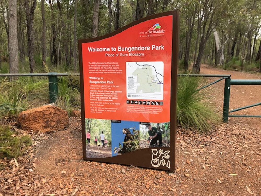
The 498ha Bungendore Park Bushland Reserve is home to a wide variety of plants and animals. It's part of the Wungong Regional Park. In fact, its location on the western edge of the Darling Scarp means the park displays a wide range of soils, topography and vegetation types, producing well over 300 different plant species.
Most of the park is open Jarrah-Marri forest with a typical suite of understorey shrubs and orchids. The park also features many blossoms - a fact which helped it to earn its name, which means 'place of the gum blossom' and 'top of a hill' in local Aboriginal language.
Bungendore Park is situated on the edge of the Darling Scarp, with sweeping views to the Swan Coastal Plain. It's located three kilometres south-east of Armadale and can be accessed from Admiral Road. Walkers can set out on marked trails located throughout the reserve.
A committee of Council, known as the Bungendore Park Management Committee, assists in the management of the area. Bungendore Park Strategic Directions September 2009also helps guide management activities.
The Bungendore Park Environmental Group, a Committee of volunteers, provides oversight on the management of the reserve.
Difficulty
Grade 2 Bush Walk - No prior bushwalking experience required. The surface of the track is hardened or compacted, and it may include a modest incline portion or sections, as well as occasional steps. Walks of no more than 10 kilometres. This is a good option for families with young children.
Location
There are two main access points to Bungendore Park – one from Dryandra Drive off Albany Highway east of Armadale, the other from Admiral Road near the Southern Hills Christian College entrance. Vehicle access to within the park is restricted to only authorised vehicles.